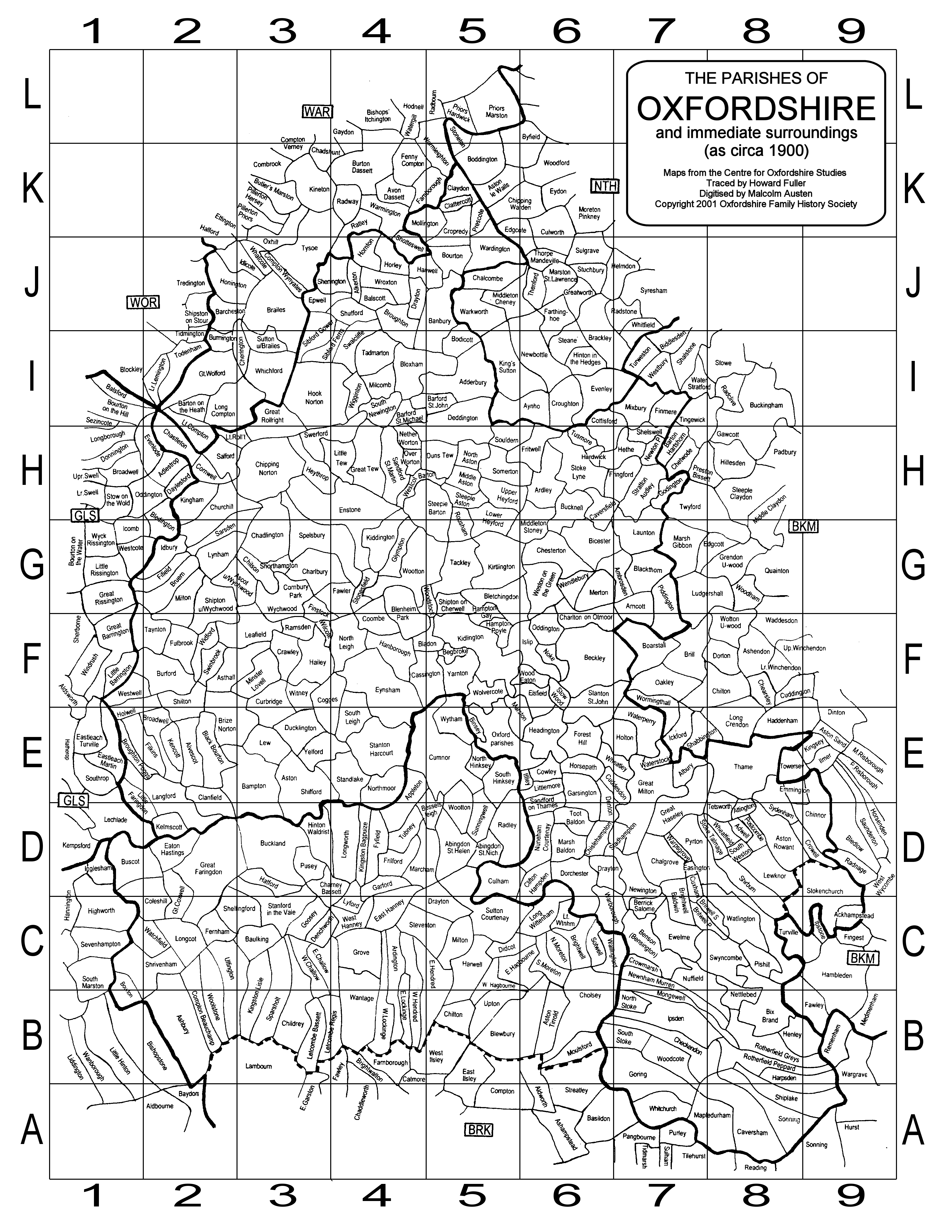
About the parish map
This map was traced by Howard Fuller from material in what was then the Centre for Oxfordshire Studies in central Oxford. The archive is now held at the Oxfordshire History Centre at St Luke’s in Cowley.
It is in black and white and shows both the original county of Oxfordshire and those parts incorporated, mainly from Berkshire, in the 1974 reorganisation.
In order to save a copy of this map, right click on the image below and select ‘save/save picture as’. You can also view the map in detail and move around it to view specific areas, by clicking on the little magnifying glass in the bottom right corner of the picture which will open it up in a viewer.
Index to Oxfordshire parishes
This list accompanies the Oxfordshire parish map and allocates each parish to a grid reference. The index can be viewed and downloaded if you select the download item right at the bottom of this page.


No Comments
Add a comment about this page